 P.I.:
P.I.:
Mikhail Chester
Arizona State University
Year:
2015
Project Report:
NTC2015-SU-R-01_Project_Information_Form_Mikhail_Chester.pdf
NTC_2016_Information_Form_Principal_Investigator_Mikhail_Chester_March_2016.pdf
NTC2015-SU-R-01 Mikhail Chester.pdf
Subject Area:
Research
Description:
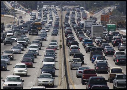
In the U.S., most urban roadway networks have been fully deployed. While outward growth still occurs, for the most part, the urban core roadway systems are no longer changing. This implies that there is a “maturing” of infrastructure. Yet at the same time, cities across the country are experiencing more and more congestion and many states and regions are unable to keep up with the long-term financing for rehabilitation to maintain high quality infrastructure. A saturated and deteriorating urban roadway system has the potential to compromise passenger and goods movement services thereby creating economic impacts for the city. New knowledge is needed to better understand i) how passenger and freight travel is effected by a roadway network that is becoming increasing saturated and ii) how this saturation may affect vehicle travel thereby impacting economic activity and changing transportation energy use.
We will develop a model of the historical growth of roadways from the beginning of Los Angeles (approximately 1900) to today by combining a statistical assessment of building ages in building assessor databases with GIS analysis of roadway networks. To do this we will start by developing a geospatial analysis that overlays the current building assessor databases at parcel scale, roadway network atlases, and travel analysis zones. Figure 1 shows the growth of each city based on building assessor databases. For each travel analysis zone, we will determine the modern day distribution of building ages. We estimate that there will be roughly 20-50 buildings per travel analysis zone. Following, we will assign the oldest building vintages to roadway links within the travel analysis zone under the assumption that buildings and roadways were deployed around the same time. For example, if for a particular zone we find that the oldest buildings are from the 1930s era we will assign that vintage to the roadway links that service those buildings. We will assess freeways and interstates separately since they were likely constructed more systematically. The result will be a spatially explicit model of the growth of the roadway network over time. We will validate the model through the review of historical satellite photos. We will join the infrastructure growth model with an assessment of changes in VMT. We will start by using county-scale data for Los Angeles and historical travel demand model output at the travel analysis zone scale that we have already acquired from the Southern California Association of Governments. We will start our analysis with Los Angeles because travel in that region has peaked (FHWA 2012) and the infrastructure is mature. We will compare the VMT estimates to VMT projections that were developed in the past 10-20 years to assess how much travel was anticipated but did not occur. We will then use elasticity estimates of fuel price, income, fuel economy, population, lane miles, and other factors to assess the potential supply and demand drivers of VMT changes for both passenger and freight. We anticipate that there will be many elasticity estimates available and we will focus on region-specific past research. We will also focus on developing an uncertainty assessment around the plethora of elasticity factors available to characterize in the best or worst case, how much those variables explain the changes in VMT.
The results of the project can be used as a foundation for twenty-first century transportation infrastructure investment that balances environmental conditions with environmental impacts at a time when mobility dominated by personal vehicle travel may be changing. By improving our understanding of how passenger and freight activities have responded to the growth of cities we will be better positioned to recommend to cities how they should invest in next generation infrastructure to better facilitate the growth that is expected in many major US metropolitan regions in the coming century.
Top